
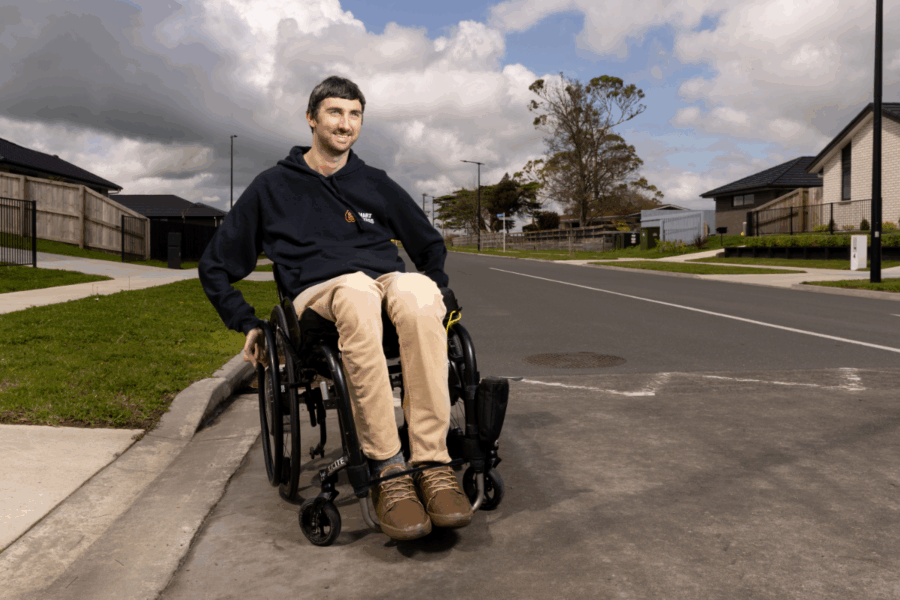
For many disabled and older people, the uncertainty of a new journey—steep paths, missing crossings, or a lack of toilets and seats—can be enough to stay home. Hamilton startup Access Quest is changing that with technology that makes travel safer and more accessible.
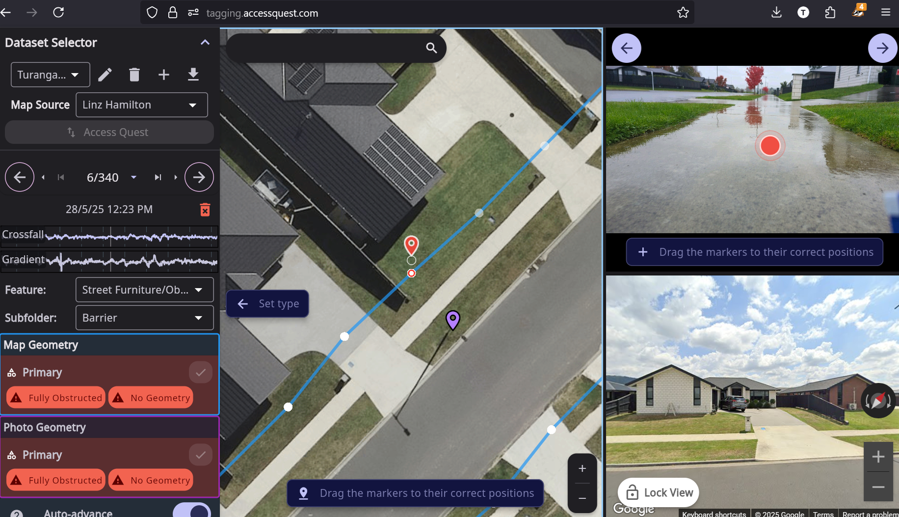
“Having navigated countless challenges while travelling the world as a tetraplegic, I wanted to turn my personal experience into something useful,” says founder Tim Young. Drawing on his background as a researcher, app developer, and CEO, he created an app called Smart Access Navigation that highlights barriers and provides personalised routes. What began as consulting work collecting accessibility data for councils has grown into a platform mapping 40 features of city infrastructure—helping councils prioritise upgrades and giving disabled people the confidence to travel more freely. “We needed a way to make that complex data easy to navigate,” Young notes.
The app provides turn-by-turn directions tailored to a user’s specific needs. Unlike competitors that only assess venues, Smart Access maps the infrastructure itself—footpaths, crossings, gradients, and obstacles—helping people explore new places with confidence.
The technology goes beyond static accessibility maps. With Smart Access Navigation, users can select from preset profiles (such as vision impairment or mobility aid use) and fine-tune variables to generate routes that meet their personal requirements.
“It’s completely personalisable,” says Young. “The difference between the route suggested for a blind person versus someone with a guide dog, for example, can be significant.”
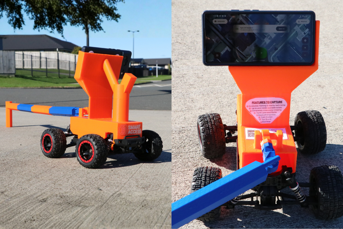
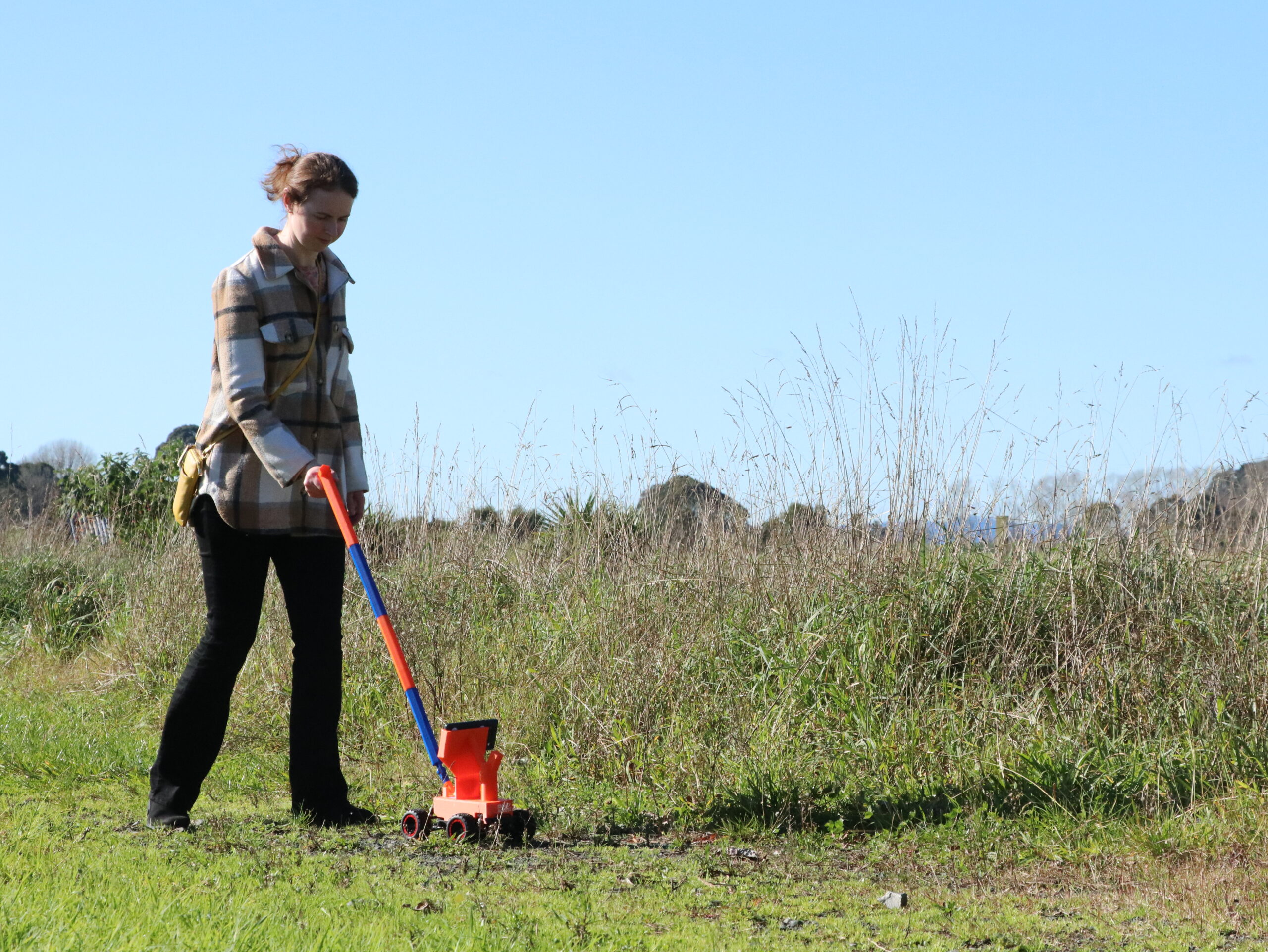
A major barrier had always been the cost of collecting high-quality infrastructure data—previously around $350 per kilometre. But in a breakthrough, Access Quest has developed a 3D-printed Access Cart that turns an ordinary smartphone into a powerful surveying tool. Anyone—from council staff to students, families, or advocacy groups—can attach their phone and walk their streets, collecting rich data on gradients, surface quality, crossings, and amenities like seating, shade, or water fountains.
“That’s what’s exciting,” says Young. “It’s now accessible to everyone. Even if you’re just a caring auntie, you can borrow one for a couple of weeks, walk your neighbourhood, and improve life for your community.”
The company’s ability to produce a low-cost cart opens the door for councils to survey their cities more comprehensively and frequently. A team of ten walking for three hours can cover 150 kilometres—enough to map a third of a smaller city in a single outing. Councils can then sign up to the Tagging Platform to gain access to the full 40 features as well as Footpath Condition surveys.
For councils, the payoff is clear. Instead of relying on static paper maps with just a handful of variables, they can access dynamic, high-resolution data across 40 features of the pedestrian environment.
“It’s a huge step up,” says Young. “Councils can prioritise infrastructure spending better, making decisions based on rich, city-wide datasets rather than limited snapshots.”
So far, around fifteen councils across New Zealand and Australia have adopted Smart Access Navigation, alongside a national organisation using it on their trails. A city in the North Island is preparing to roll it out across their district, and the technology is already being trialled in Sydney.
The community also benefits directly. Disabled people and families can plan new journeys with confidence, knowing where safe crossings, ramps, or resting spots are located. Businesses and organisations are joining in too, with healthcare teams running competitions to collect data for their local communities.
Like many startups, Access Quest’s path has been shaped by a mix of grants, contracts, and sheer perseverance. Early support included a TSB Good Stuff grant, funding from Internet NZ, and a Waka Kotahi Innovation Fund investment that helped build the personalisable navigation system. More recently, grants supported development of the Access Cart, machine learning models, and step-by-step audio navigation for blind users.
Young is candid about the challenges. Balancing contract delivery, product development, and limited capital meant long stretches without paying himself. “It’s just that constant juggling act,” he says. “Getting contracts, delivering them, and using any surplus for R&D.”
Today, the company is profitable and midway through an angel investment round to scale further. With the technology nearly complete, Young’s next focus is scaling adoption. Globally, the potential is vast. There are around 80 councils in New Zealand and more than 500 in Australia, with countless more opportunities abroad.
Asked what advice he’d share with aspiring founders, Young is clear. “You just need to start and go for it. You’ll never know unless you try,” he says. He recalls applying for the TSB Good Stuff grant despite illness and bad weather. “I pulled together the best video I could in three days, and it paid off. It’s about having that self-belief and conviction.”
As Access Quest prepares for wider rollout, Young’s message is two-fold. Councils have an opportunity to radically improve the way they collect and use data to prioritise spending. At the same time, communities can get involved directly, mapping their neighbourhoods with affordable carts.
The result is a future where more people, regardless of ability, can explore their cities with confidence.
Story by Katherine Blaney


